This guide is for a desert bighorn applicant—or one of the few 2026 permit holders—who needs to turn a rare tag into a safe canyon-country plan. The practical question is: how should a hunter connect forage, visibility, escape terrain, heat and legal access without reducing desert sheep to one water source or one remembered location?
The comparison matters now because Utah DS6604, La Sal, Potash/South Cisco and DS6610, San Rafael, South are open through November 10, 2026. DS6620, Pine Valley, Virgin River opens October 24 and runs through December 25. Their weapon and tag system are the same, but their season timing, land pattern and physical access problem are not.
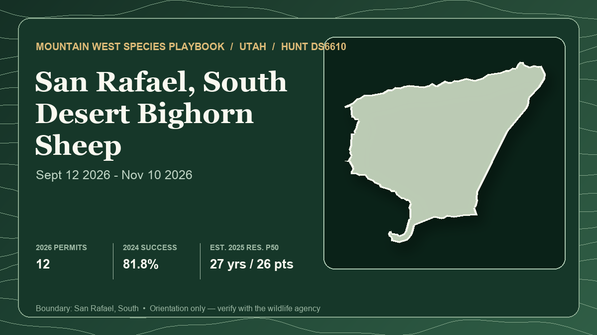
Hunt Planner's structured desert-bighorn records are Utah-only, so a defensible multi-state comparison is not available. This article compares three supported Utah hunts instead of importing unlike records. The card above represents lead hunt DS6610 only, not the full comparison. Its 81.8% harvest field is final 2024 data from the local profile; the analysis below uses Utah's newer preliminary 2025 report and labels that difference.
Build the search around a canyon-country habitat system
Utah's statewide plan describes desert bighorns in slickrock canyons, rocky slopes and the Colorado Plateau's river systems. Unlike many Rocky Mountain bighorns, desert bighorns generally do not make distinct summer-to-winter migrations. That makes a durable habitat system more useful than a calendar-based migration assumption.
Start with four connected elements:
- Open forage. Grasses and forbs are primary foods, with shrubs used seasonally. An attractive green strip or bench still needs nearby security and visibility.
- Horizontal visibility. Sheep favor terrain where they can detect danger. Dense pinyon-juniper or a convoluted canyon can look rugged while interrupting the openness that makes adjacent habitat useful.
- Escape terrain. Steep rock, talus, ledges and broken slopes provide security. The objective is to observe habitat next to escape terrain, not to climb the most hazardous line on the map.
- A legal observation-and-recovery route. A visible ram across a national-park boundary, Tribal parcel, cliff band or closed motor route is not a workable opportunity.
Water belongs in the model, but not as a pin. The Pine Valley unit plan explains that desert bighorns can use moisture from metabolism, food, dew and surface water; actual surface-water need changes with temperature, humidity, activity and forage moisture. In hot, dry periods sheep may drink frequently, but those physiological adaptations make a rigid “sit one water source” plan poor evidence. Compare broad water availability, current forage and connected escape terrain without publishing springs, guzzlers, approaches or animal coordinates.
Timing changes heat, daylight and social behavior
Utah surveys bighorns near the peak of the rut, generally from late October into December depending on the unit. DS6604 and DS6610 began September 12, so their long seasons span hot early conditions, shorter autumn days and at least part of that broad breeding window. DS6620 starts October 24 and places all 63 days closer to the rut and winter.
Later does not automatically mean easier. Rut activity can change group structure and make rams more visible, while cold fronts can make roads, slickrock and shaded canyon travel less forgiving. An early-period plan should protect water, shade, meat care and a turnaround time. A late-period plan needs short-daylight margins, a weather-independent exit and a clear rule for abandoning a route after rain, snow or freeze-thaw.
Utah defines a legal ram as a male desert bighorn older than one year. Use several characteristics and enough observation time to confirm sex; do not convert horn curl into an unsupported field-age promise. The 2026 regulations also ask hunters to avoid collared animals when possible because collars support migration and survival studies.
Keep 2025 evidence separate from the 2026 hunt
All three hunts use Utah's once-in-a-lifetime desert bighorn bonus-point drawing. Bonus permits reward applicants at the high end of the point pool, while regular permits preserve a random path. A low-point regular permit in one historical row proves that a chance existed; it does not establish a draw threshold.
The 2026 guidebook lists the desert bighorn permit at $564 resident and $3,988 nonresident. A valid hunting or combination license, application fee and transaction charge are separate, so those permit prices are not total trip or application costs.
The latest draw rows used here are 2025. Current seasons and quotas are 2026. The newest hunt-level harvest table is preliminary 2025, while the lead card and static profiles retain final 2024 harvest. No percentage below combines those years into a forecast.
Hunt 1: DS6604 — river-canyon scale, resident-only tag
- Current season and weapon: Male-only desert bighorn, any legal weapon, September 12–November 10, 2026. The approved allocation is eight resident permits and no nonresident permit, up from six total permits in 2025.
- Tag path and latest draw demand: Utah once-in-a-lifetime desert bighorn bonus-point drawing. In 2025, 424 eligible residents sought six permits, an aggregate 1-in-70.7 ratio. Three were bonus permits and three were regular permits. Regular permits appeared at 17, eight and four points; none of those levels is a repeatable threshold.
- Latest harvest result: Utah's preliminary 2025 table lists seven hunters, seven rams, 100% success and 7.7 average days. The final 2024 local profile lists seven hunters, seven rams and 9.3 average days. Seven hunters are still a small sample, and the 2026 quota is eight.
- Public-land and access pattern: The 2019 unit plan estimates modeled bighorn habitat as 47.9% BLM, 43% national park, 5.6% Utah trust land and 1.9% private, with smaller categories making up the balance. The hunt boundary excludes all national parks. Modeled habitat inside a park therefore describes the herd landscape, not huntable acreage; Canyonlands prohibits hunting and firearm discharge.
- Terrain character: The unit plan describes rugged, deep side canyons along the Green and Colorado river corridors, steep talus, open canyon bottoms and pinyon-juniper mesa tops. High recreation use can add disturbance, and river corridors can separate visible habitat from a safe approach.
- Principal tradeoff: DS6604 has the most favorable 2025 aggregate resident ratio and the strongest latest harvest headline in this comparison, but it is resident-only and its large national-park habitat share makes boundary discipline central.
- Best for: A Utah resident who can distinguish the legal hunt from the broader biological unit, observe several canyon systems and plan a recovery route that never depends on park ground.
Open DS6604 in the Hunt Planner 3D map.
Hunt 2: DS6610 — the lead hunt and only nonresident path here
- Current season and weapon: Male-only desert bighorn, any legal weapon, September 12–November 10, 2026. The allocation is 10 resident and two nonresident permits, 12 total.
- Tag path and latest draw demand: Utah's once-in-a-lifetime desert bighorn bonus-point drawing. The 2025 report contains 789 eligible residents for 10 permits and 2,003 eligible nonresidents for two permits. Those raw aggregate ratios are about 1 in 78.9 and 1 in 1,001.5, but they collapse point tiers. Resident regular permits appeared at 25, 21 and 18 points; the nonresident regular permit appeared at 13. Those are historical random outcomes, not thresholds.
- Latest harvest result: Preliminary 2025 data list 12 hunters, 11 rams, 91.7% success and 11.2 average days. The lead card's final 2024 row lists 11 hunters afield, nine rams, 81.8% success and 8.3 days. The newer year had a higher percentage and longer effort; neither predicts 2026.
- Public-land and access pattern: The San Rafael plan estimates South-subunit modeled habitat as 88.1% BLM and 10.9% Utah trust land, with smaller state, private and national-park shares. Those are habitat-model shares, not legal-ingress percentages. BLM's 2026 route reassessment says existing San Rafael Swell designations remain in effect unless a new decision changes them; a proposed reopening is not an open route.
- Terrain character: This is high-desert canyon, cliff and bench country. The official plan connects sheep habitat to steep escape terrain, ruggedness, forage and horizontal visibility. BLM's current recreation page also notes deep canyons, expansive rock and heavy recreational use, so road status and human traffic deserve a same-week check.
- Principal tradeoff: DS6610 supplies the only 2026 nonresident permits among these three and the largest sample. It also had the longest 2025 effort among the two early-opening hunts, and nonresident demand was extreme. The 2026 guidebook footnote allows a DS6610 nonresident to hunt both San Rafael North and South; the local static profile and lead card depict South only.
- Best for: A resident or exceptionally fortunate nonresident who values a broad September-to-November window and can maintain several legal observation systems as heat, recreation and route conditions change.
Open DS6610 in the Hunt Planner 3D map.
Hunt 3: DS6620 — later Virgin River timing, smaller sample
- Current season and weapon: Male-only desert bighorn, any legal weapon, October 24–December 25, 2026. The allocation is three resident permits and no nonresident permit.
- Tag path and latest draw demand: Utah once-in-a-lifetime desert bighorn bonus-point drawing. In 2025, 650 eligible residents sought three permits, an aggregate 1-in-216.7 ratio. Two bonus permits went at 29 and 28 points; the regular permit appeared at 20 points. That 20-point result is not a forecast.
- Latest harvest result: Preliminary 2025 data list three hunters, two rams, 66.7% success and 15 average days. The final 2024 local row was two hunters, two rams and 8.5 average days. A one-animal difference moves the percentage sharply when only three people hunt.
- Public-land and access pattern: The Pine Valley plan estimates Virgin River modeled habitat as 77% BLM, 12.3% Tribal, 7.2% Utah trust land and 3.5% private. Those percentages do not grant access across Tribal or private land. The BLM describes parts of the Virgin River complex as rugged, roadless and difficult to access; nearby urban development and major highways do not make every canyon simple.
- Terrain character: Sandstone cliffs, river breaks and lower Mojave-edge country replace the San Rafael's vast plateau scale. The same forage-visibility-escape framework applies, but the later dates increase the importance of rut-period observation, short daylight and a cold-weather canyon exit.
- Principal tradeoff: DS6620 offers the strongest late-season overlap and the smallest current permit pool, with the least favorable 2025 aggregate ratio and weakest preliminary harvest result here. The sample is too small for a quality judgment.
- Best for: A Utah resident who can commit time near the late-October-to-December rut window and solve mixed-jurisdiction access before assuming the long season creates flexibility.
Open DS6620 in the Hunt Planner 3D map.
A field framework that transfers
- Build three complete observation systems. Each should link a legal entry, durable glassing area, forage, visibility, escape terrain and a reversible recovery route. A sheep sighting without lawful access is not a plan.
- Let current conditions select the system. Test shade, forage moisture, fresh sign, human disturbance and safe travel. Do not force an old scouting observation after heat, rain or pressure changes use.
- Budget movement conservatively. Canyon distance is not map distance. Include the descent, river or cliff barrier, loaded return, darkness and the possibility that slickrock becomes unsafe when wet or frozen.
- Observe before closing distance. Confirm a legal ram, assess what lies behind it and identify where an animal could fall. A shot that creates an unrecoverable descent is not a good opportunity.
- Keep water and location data private. Discuss habitat patterns, not guzzlers, springs, beds, camps, private approaches, observation points or coordinates.
- Carry the current legal layers. Use the DWR boundary with present ownership, park, Tribal, wilderness and land-manager travel maps. A BLM or modeled-habitat percentage does not prove motorized access.
Best fit by hunter priority
- For the strongest 2025 resident draw headline: DS6604's aggregate ratio was 1 in 70.7, compared with about 1 in 78.9 for DS6610 and 1 in 216.7 for DS6620. Point tiers and changing quotas prevent turning that order into personal odds.
- For a nonresident: DS6610 is the only compared hunt with 2026 nonresident permits. Its two 2025 permits faced 2,003 eligible applicants, and the license's North/South authorization requires additional boundary work beyond the South profile shown here.
- For later rut overlap: DS6620 opens October 24 and runs through December 25. DS6604 and DS6610 close November 10 after spanning more early-season heat.
- For the strongest latest harvest result: DS6604 reported seven of seven in preliminary 2025 data, DS6610 11 of 12 and DS6620 two of three. Samples of seven, 12 and three cannot support a universal quality ranking.
- For the clearest public-management headline: The San Rafael South plan estimates 88.1% of modeled habitat as BLM. DS6620 lists 77% and DS6604 47.9%, but DS6604 also includes a 43% national-park habitat share that is excluded from the hunt. These are habitat shares, not accessible-acre scores.
There is no universal winner. DS6604 best fits the resident who can manage a river-canyon unit with major park exclusions. DS6610 best fits a hunter who needs the only compared nonresident path or wants the broadest current permit pool. DS6620 best fits a resident prepared to trade much steeper historical demand for a later rut-and-winter window.
Verification checklist before applying or hunting
- Confirm hunt number, current boundary, ram definition, season dates, legal weapon, quota and residency allocation on the live DWR listing.
- Keep 2025 draw results, preliminary 2025 harvest and 2026 quotas in separate columns. Do not turn a regular-permit point row into a guaranteed threshold.
- Recheck national-park exclusions, Tribal and private permission, Utah trust-land requirements, wilderness, closures and current motor-route designations.
- Check weather, flash-flood risk, road condition, fire restrictions, daylight and communications immediately before each access attempt.
- Build a conservative shot, fall-zone, recovery and meat-care plan. Avoid collared sheep when possible and follow all tagging and evidence requirements.
- Submit Utah's mandatory harvest report within 30 days of the season ending, even if no ram is taken. Utah no longer requires a horn plug.
- Keep all terrain guidance at habitat-pattern level. Do not publish camps, water sources, routes, glassing points or animal coordinates.
The Hunt Planner methodology explains how report years and draw systems are preserved, and the corrections page accepts source mismatches. This article was researched and drafted with AI assistance, then checked against the linked structured records and official sources under the editorial and AI policy. No anecdotal hunter report is used as representative evidence.
Sources and verification
- Utah DWR Hunt Planner: DS6604 current boundary
- Utah DWR Hunt Planner: DS6610 current boundary
- Utah DWR Hunt Planner: DS6620 current boundary
- Utah DWR 2026 Big Game Application Guidebook: seasons, fees and DS6610 nonresident authorization
- Utah DWR 2026 once-in-a-lifetime permit table: current quotas
- Utah DWR 2025 once-in-a-lifetime drawing odds
- Utah DWR big-game harvest dashboard: preliminary 2025 hunt-level results
- Utah DWR 2026 Big Game Field Regulations: ram definition, reporting and collar guidance
- Utah DWR statewide bighorn plan: desert habitat, movement and rut survey timing
- Utah DWR La Sal, Potash/South Cisco unit plan
- Utah DWR San Rafael unit plan
- Utah DWR Pine Valley unit plan
- BLM May 2026 San Rafael route reassessment: existing designations remain effective
- BLM San Rafael Swell Recreation Area: current travel-plan context
- BLM Virgin River complex: terrain and access context
- National Park Service Canyonlands regulations: hunting and firearm discharge prohibited
Official seasons, quotas, draw rules, boundaries, park and Tribal restrictions, route designations, closures and weather can change. The article-level harvest figures are preliminary 2025; the static profiles and lead card use final 2024 harvest. Unit plans contain older biological and ownership context, not live access guarantees. Verify every source again before applying and immediately before entering the field.