Idaho deer Hunt 1031 is a late-season controlled hunt with a strong recent harvest record and a sharply more crowded 2026 drawing. Idaho Fish and Game reports 6,182 first-choice applicants in 2026, up from 5,482 in 2025, for the same 200-tag quota. That 12.8% year-over-year increase is the planning fact to remember: the hunt did not become more available just because its permit count remained stable.
The immediate calendar also matters. Successful 2026 controlled-hunt applicants must buy their tags by August 1, 2026. A forfeited tag can move to Idaho's second drawing, but the current first-draw demand does not establish that Hunt 1031 will be offered. Unsuccessful applicants should use the official list when the August 5–15 second-draw period opens, not plan around a presumed leftover.
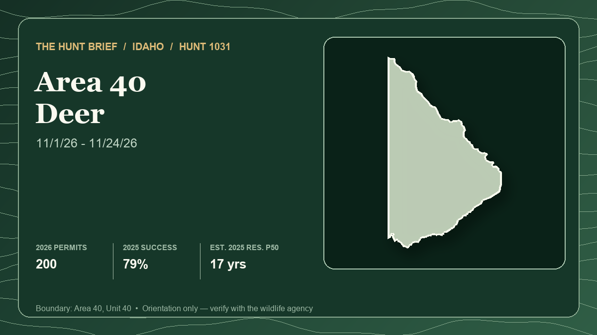
Start with the static Hunt Planner profile for Hunt 1031 and open Area 40 in the Hunt Planner 3D map. The card above shows the 2026 season and quota with the latest local harvest and draw history; its boundary is an orientation graphic, not a substitute for the current agency map or an ownership product.
The quick verdict
Hunt 1031 best fits a hunter who specifically wants a November 1–24, 2026 antlered-deer season in the open, broken country of Area 40 and is willing to treat access and weather as primary constraints. The latest three harvest reports are notably consistent—79% success in 2025, 80% in 2024 and 81% in 2023—but the 2026 draw remains a narrow random chance.
Idaho lists the hunt for antlered mule deer or white-tailed deer with any weapon and no special hunt restriction. The 2025 harvest was 99% mule deer, so the useful planning frame is a southern Idaho mule deer hunt without pretending the tag excludes a legal whitetail.
What changed in the 2026 drawing
IDFG's current Hunt Planner table separates residents and nonresidents. In 2026, 5,008 resident first-choice applicants competed for 180 resident awards, displayed by the agency as 4% success after rounding. The corresponding 2025 totals were 4,731 applicants and 180 awards, also displayed as 4%.
The larger change was in the nonresident pool. IDFG reports 1,174 nonresident first-choice applicants and 20 awards in 2026, displayed as 2%. In 2025, there were 751 first-choice applicants for the same 20 awards, displayed as 3%. Nonresident demand therefore increased by 423 applicants, or 56.3%, in one year.
The unrounded 2026 award-to-applicant ratios were about 3.59% for residents and 1.70% for nonresidents—roughly one award for every 27.8 resident first choices and one for every 58.7 nonresident first choices. Those are historical ratios for one random drawing, not a forecast. Idaho does not use preference points for controlled hunts, and an unsuccessful applicant gains no higher point tier for 2027.
Second-choice history needs equal care. Four tags entered the 2025 second drawing after the original awards, but that does not predict 2026 availability. First-drawing winners have until August 1, 2026 to claim tags, and only tags actually remaining will be listed for the August 5–15 second application period.
What the 2025 harvest report says
The latest completed harvest row is 2025, one year behind the current 2026 season and draw. IDFG reports 196 hunters, 155 harvested deer and 79% success. The 1,170 total hunter-days work out to about 6.0 days per reporting hunter. In 2024, 189 hunters harvested 150 deer for 80% success; in 2023, 201 hunters harvested 163 deer for 81%.
That three-year band is more informative than a single percentage, but it still does not make an individual outcome likely. November weather, deer movement, legal access, time afield and the location of other hunters all affect the result. Harvest success also describes people who held the permit and hunted, while drawing success describes applicants trying to obtain it; the two percentages answer different questions.
IDFG also reports that 84% of the 2025 antlered harvest had four or more antler points. That is an antler-class observation, not a draw-point statistic. It should not be turned into an age claim or a trophy guarantee. Only 1% of the 2025 harvest was reported as whitetail.
Public land is abundant, but access is not automatic
The official hunt page defines Area 40 as all of Unit 40 and lists 1,447,543 acres. Its current surface-management summary is 65.5% Bureau of Land Management, 24% private, 9.9% State of Idaho, 0.5% Bureau of Reclamation and 0.1% other. The same page identifies 44,684 acres of the North Fork Owyhee Wilderness, 3.1% of the hunt area, where motorized vehicles are prohibited.
Those figures are encouraging for a public-land plan, but management is not the same thing as a legal approach. A public parcel can be functionally difficult to reach when the obvious road crosses private land, and a mapped route is not proof that it is open to the vehicle being used. IDFG currently lists no Access Yes! property in the hunt area.
BLM's Canyonlands East travel-management decision is a useful reminder of the right workflow: motorized travel depends on designated routes, not the amount of public color visible on a map. Confirm the current route designation, seasonal closure, fire restriction and private-property status shortly before travel. The live BLM Idaho advisories and fire-restrictions pages are more useful than a saved summer screenshot for a November hunt.
A November Area 40 scouting framework
The 24-day season can overlap autumn movement, changing forage and the approach to the mule deer breeding period. IDFG research shows that mule deer migrations can be predictable, but the timing and distance vary by herd. A November date is therefore a reason to monitor broad habitat transitions—not permission to assume every buck will be migrating or rutting on opening morning.
Build the plan in layers:
- Compare broad sagebrush benches, broken canyon rims and nearby security cover. Look for connected feed, bedding and escape habitat rather than one isolated opening.
- Prepare at least two elevation bands and two legal access systems. A storm may improve visibility while making a preferred road unsafe or impassable.
- Use long observation periods from durable ground before adding foot traffic to a basin or drainage. The goal is to understand movement between habitat types, not publish or chase a precise glassing point.
- Pair every potential approach with land status, route designation and a realistic retrieval. Open terrain can make distance and canyon relief look easier than they are.
- Recheck active fire closures and restrictions even in late autumn. Summer incidents, rehabilitation closures and wet-road limits can persist after the headline fire danger changes.
Keep e-scouting at the habitat-pattern level. Do not share camps, exact approaches, water sources, private-land crossings, GPS points or animal locations. The Hunt Planner 3D view is useful for comparing large-scale relief and access alternatives, while IDFG and the land manager remain authoritative for the hunt boundary and travel rules.
Who should plan around Hunt 1031
This is a logical application target for someone who wants a late southern Idaho mule deer season, has enough time to absorb weather disruption and can validate access across a very large unit. The 2023–2025 harvest record supports serious consideration, especially for a hunter who can scout several public-land sectors instead of betting on one road.
It is a poor fit for anyone treating the rounded 4% or 2% as a stable annual promise, relying on a second-draw tag, or assuming 65.5% BLM management means easy motorized access. It is also not an efficient choice merely because the 2025 success rate was high: 2026 first-choice demand grew while permit supply did not.
If you drew in 2026, claim the tag by August 1 and move immediately to current route, closure and weather planning. If you did not draw, check the official second-draw list during August 5–15 and apply only if Hunt 1031 actually appears. For a future application, compare its random odds and late-season field demands with your ability to scout Area 40 before making it a first choice.
Sources and verification
- IDFG Hunt Planner: Hunt 1031 current season, quota, 2026 draw, 2025 harvest, surface management and wilderness
- IDFG 2026 Big Game Seasons and Rules
- IDFG controlled-hunt results and August 1, 2026 tag-purchase deadline
- IDFG controlled-hunt application periods and second-draw guidance
- IDFG deer and elk movement research
- BLM Canyonlands East travel-management decision
- BLM Idaho advisories and closures
- BLM Idaho fire restrictions
Official regulations, tag availability, route status, closures, fire restrictions and access can change. The draw figures are from 2026, while harvest evidence is from 2025 and earlier completed seasons; they should not be combined into a single score. This article uses official agency material only, and no hunter report is presented as evidence. It was prepared with AI-assisted research and drafting, then checked against the linked sources. Read Hunt Planner's methodology, editorial and AI policy and corrections process.