This guide is for a Mountain West deer hunter who knows that “hunt the edge” is not yet a plan. The useful question is: which edge—timber and openings in northern Idaho, or creek bottoms and irrigated meadows in eastern Wyoming—and can the hunter legally reach the habitat that actually holds whitetails?
That comparison matters now because Wyoming 010-3, Hunt Area 10 and Wyoming 022-3, Hunt Area 22 are already open through November 30, 2026, while Idaho Hunt 1116, Area 1-1X opens November 1 and runs through December 1. All three are any-weapon limited-entry whitetail hunts. They are not interchangeable: Idaho is antlered-only in a predominantly forested landscape; both Wyoming Type 3 licenses allow any white-tailed deer across more open country where the agency warns that whitetails often occupy private riparian and agricultural habitat.
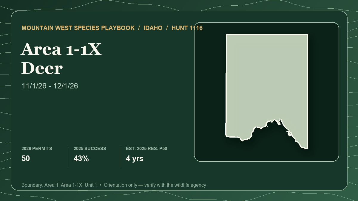
The card above represents lead hunt Idaho 1116 only, not the three-hunt comparison. It shows Area 1-1X, the portion of Unit 1 in Boundary County east of the Selkirk Mountains crest. No harvest percentage, public-land share or draw result below should be converted into a universal whitetail score.
“Edge” is a relationship, not a line on a map
Idaho's white-tailed deer plan describes a useful habitat mosaic: early- and mid-successional vegetation can supply diverse forage, while mature forest supplies travel, screening, security and winter cover. The plan warns that a landscape's value changes with succession and says both mature and early-seral stands matter. In practical terms, a fresh opening without nearby cover may be too exposed, while uninterrupted mature canopy may offer security but little reachable forage.
Wyoming presents a different version of edge. The agency's current guidance says most white-tailed deer outside the Black Hills occupy private lands along creek bottoms and irrigated meadows. Riparian vegetation, cultivated feed, adjacent brush and broken uplands can create a narrow band of useful habitat inside a very large hunt area. A public-land percentage therefore may describe the area accurately while saying little about access to the species.
Across both settings, build the search around four connected functions:
- Available forage. In Idaho, compare early-seral browse, forest openings and agricultural influence. In Wyoming, compare creek bottoms, meadow edges and adjacent cover without assuming permission follows habitat.
- Daylight security. Conifer, brush, folds and other screening features shorten the distance between feeding and bedding. Pressure can make the obvious edge nocturnal.
- Low-impact observation. Open Wyoming habitat may permit long glassing. Northern Idaho can require shorter sightlines and slower confirmation of tracks, rubs and feeding use.
- Legal entrance and recovery. A public polygon, road line or visible animal does not establish permission. Solve ingress, weapon restrictions, retrieval and carcass handling first.
The October-to-December window also changes the search. Colder weather, shortening days, hunting pressure and breeding behavior can alter daylight movement, but no calendar date guarantees a buck will abandon security cover. Treat a new track, sighting or crossing pattern as current evidence; treat a remembered November waypoint as a hypothesis.
Keep the evidence systems separate
Idaho uses a random controlled-hunt drawing without preference points. Wyoming separates resident demand from nonresident regular and special pools, then divides nonresident licenses between preference and random drawings. Idaho's displayed draw percentage and Wyoming's pool-specific results are not the same measure.
The harvest reports are also different products. Idaho compiles mandatory hunter reports and check-station records. Wyoming publishes survey estimates. Idaho's 43% is 15 deer from 35 hunters; Wyoming 010-3's 68.18% is 15 deer from 22 hunters; and Wyoming 022-3's 65.22% is 45 deer from 69 hunters. Small samples, different reporting systems and different landscapes prevent a fair ranking.
Current costs are omitted because required licenses, tags, charges, residency and Wyoming draw pools differ. Verify the complete current cost path for the applicant who will apply.
Hunt 1: Idaho 1116 — forest mosaic and mandatory CWD logistics
- Current season and weapon: Controlled Hunt 1116, antlered white-tailed deer, any weapon, November 1–December 1, 2026, with 50 tags. The hunt covers the portion of Unit 1 in Boundary County east of the Selkirk Mountains crest, approximately 695,231 acres. Idaho also posts a grizzly-bear caution for the area.
- Tag path and latest draw demand: Idaho random controlled-hunt draw; no preference points. The official 2026 first drawing lists 225 first-choice applicants for 50 permits, displayed as 22%. Residents received 48 permits from 212 first choices, or 23%; nonresidents received two from 13, or 15%. A separate second drawing can redistribute unclaimed tags, so it should not be merged into first-choice odds.
- Latest harvest result: Idaho's 2025 mandatory report lists 35 hunters, 15 antlered whitetails and 43% success over 261 hunter-days, or about 7.5 days per hunter. The table classifies 36% of measured bucks in its five-or-more-points category. That antler classification is not a draw-points measure.
- Public-land and access pattern: The hunt page publishes no surface-management breakdown for Area 1-1X and lists no current Access Yes property. The broader Unit 1 page estimates 52.24% Forest Service, 29.19% private and 15.64% state management. Those unitwide shares include land outside the hunt boundary and do not prove legal ingress.
- Terrain character: Unit 1 is summarized as 77.62% forest and 14.43% dryland agriculture. Compare reachable browse and openings with screening cover, then use current sign to decide whether an edge is active during legal light.
- Principal tradeoff: This is the only antlered-only hunt in the comparison and the only Idaho random draw, but it carries the most explicit disease and recovery obligations. All harvested deer in this part of Unit 1 require a CWD sample within 10 days, and carcass-transport restrictions apply outside the management zone.
- Best for: A hunter comfortable reading short-range forest patterns, prepared for grizzly country, and willing to design sampling and carcass disposal before opening morning.
Open Idaho 1116 in the Hunt Planner 3D map.
Hunt 2: Wyoming 010-3 — more public acreage, concentrated habitat
- Current season and weapon: Limited-quota Type 3 any white-tailed deer, any legal weapon, October 1–November 30, 2026, after a September 1–30 special archery season. Wyoming's final Chapter 6 regulation authorizes 25 licenses.
- Tag path and latest draw demand: Wyoming limited-quota drawing. The 2026 resident demand report lists 18 licenses against 48 first-choice applicants, a raw 37.5% ratio. The difference between the 25-license season quota and 18-license resident draw inventory reflects allocation mechanics; do not treat all 25 as resident first-choice supply. Nonresidents must read the regular and special preference and random reports separately.
- Latest harvest result: The 2025 survey estimates 22 active Type 3 hunters, 15 whitetails, 68.18% success and 5.7 average days. Fifteen deer are too few to turn that percentage into a durable forecast.
- Public-land and access pattern: The local Hunt Planner record estimates 58% public land. Yet Wyoming's white-tailed deer guidance says that outside the Black Hills, whitetails primarily occupy private creek bottoms and irrigated meadows and recommends securing permission before buying a license. The public-land headline and the target's distribution must be read together.
- Terrain character: Wyoming describes Area 10 as largely Thunder Basin National Grassland. The problem is locating legal overlap among water-influenced cover, feed, daylight security and access. A woody corridor can look obvious while placing deer behind a private boundary.
- Principal tradeoff: This hunt has the largest published public-land percentage and the strongest recent success headline in the comparison, but neither establishes that a public-land hunter can reach productive whitetail habitat.
- Best for: A hunter who can secure permission early or verify a complete public riparian system, then glass from outside the narrow cover instead of pushing deer toward a refuge.
Open Wyoming 010-3 in the Hunt Planner 3D map.
Hunt 3: Wyoming 022-3 — larger quota, longer effort signal
- Current season and weapon: Limited-quota Type 3 any white-tailed deer, any legal weapon, October 1–November 30, 2026, with a September 1–30 special archery season. The final regulation authorizes 75 licenses.
- Tag path and latest draw demand: Wyoming limited-quota drawing. The 2026 resident report lists 55 licenses and 92 first-choice applicants, a raw 59.8% ratio. In the nonresident special preference pool, the report shows two applicants at one point receiving two licenses; zero-point rows received none. That tiny outcome is not a stable point threshold and should not be combined with the other pools.
- Latest harvest result: The 2025 survey estimates 69 active hunters, 45 whitetails, 65.22% success and 11.6 average days. This is the largest harvest sample here, but the reported effort is roughly double Area 10's 5.7 days and longer than Idaho's 7.5. Survey effort is descriptive, not a controlled difficulty test.
- Public-land and access pattern: The local record estimates only 21% public land. Wyoming's current hunt guidance adds that central and eastern whitetails are commonly associated with private riparian and cultivated ground. Public habitat may exist, but the hunter must verify that the route, animal position and recovery all remain legal.
- Terrain character: Treat every creek bottom, irrigated edge and brushy draw as a corridor with an ownership problem attached. Observation from legal ground never authorizes a shot or recovery across a boundary.
- Principal tradeoff: Area 22 offers three times Area 10's season quota and the most forgiving current resident first-choice ratio of the two Wyoming hunts, but it has the smallest public-land headline and the longest recent effort signal.
- Best for: A hunter who values more licenses and can invest early in permission, boundary verification and several separate corridor plans rather than relying on one visible field edge.
Open Wyoming 022-3 in the Hunt Planner 3D map.
A transferable edge-hunting framework
- Intersect habitat with access. Identify forage-cover relationships, then remove every patch without verified legal entry and recovery. The remainder is the hunt plan.
- Build three independent systems. Vary forest structure in Idaho or use different Wyoming creek systems with separately verified permission. Three overlooks of one private bottom are one plan.
- Observe without spending the edge. Stay outside bedding and travel cover. Repeated entry can move deer where the hunt cannot continue.
- Separate rut expectation from evidence. Fresh sign, sightings and legal-light use determine whether a system deserves another sit.
- Plan backward from recovery. Identify property lines, backstops, route difficulty, daylight, meat cooling and disease rules first.
- Keep locations private. Share habitat patterns, not camps, landowner names, crossings, beds, observation points or animal coordinates.
Best fit by hunter priority
- For an antlered-only objective: Idaho 1116 is the only direct fit. Both Wyoming Type 3 hunts authorize any white-tailed deer, so the hunter must decide before the season whether a doe is an acceptable outcome.
- For a point-free annual draw: Idaho uses a random controlled hunt and displayed 22% overall first-choice success in 2026. That is one drawing, not a waiting-time guarantee.
- For the largest quota: Wyoming 022-3 authorizes 75 licenses, Idaho 50 and Wyoming 010-3 25. Quota does not measure huntable habitat or crowding on accessible parcels.
- For the strongest public-land headline: Wyoming 010-3 shows 58%. Its agency still warns that whitetails in this region often occupy private creek bottoms and irrigated meadows.
- For the clearest forest-edge problem: Idaho 1116. Unit 1 is predominantly forested, but its unitwide land table cannot be substituted for the smaller 1-1X boundary.
- For simpler disease logistics: Neither Wyoming hunt carries the explicit Idaho 1-1X CWD management-zone transport rules described here. Wyoming still requests or requires samples in designated areas and all hunters should verify the current CWD map before travel.
There is no universal winner. Idaho 1116 fits an antlered-whitetail forest hunter who owns the CWD plan. Wyoming 010-3 fits someone who can convert public acreage into verified habitat and access. Wyoming 022-3 fits a hunter prioritizing quota and prepared for a more private landscape and longer effort.
Verification checklist before applying or hunting
- Confirm hunt number, license type, species and sex limitation, season dates, weapon rules and quota in the current agency regulation.
- Keep Idaho random-draw results separate from Wyoming resident, special, regular, preference and random pools.
- Recheck the official boundary against current parcels, roads, gates, easements, fire restrictions and land-manager travel rules.
- For Idaho 1116, confirm the current CWD management-zone boundary, sample deadline, accepted carcass parts, drop-off locations and disposal rules before the hunt.
- Carry current grizzly-bear safety information for Idaho Unit 1 and know how to distinguish species before any shot.
- Obtain written private-land permission where required and confirm whether it includes vehicle entry and animal recovery.
- Verify tagging, evidence-of-sex, hunter-orange, harvest-reporting and carcass-import rules for every state the animal will enter.
- Keep terrain guidance at the habitat-pattern level; never publish exact access routes, landowner details, camps, beds, observation points or animal locations.
The Hunt Planner methodology explains how state-specific evidence is preserved, and the corrections page accepts source mismatches. This article was researched and drafted with AI assistance, then checked against the linked local records and official sources under the editorial and AI policy. No anecdotal hunter report is used as representative evidence.
Sources and verification
- Idaho Fish and Game Hunt 1116: current season, boundary, 2026 draw and 2025 harvest
- Idaho Fish and Game Unit 1: surface management and land-cover context
- Idaho Fish and Game 2026 Deer and Elk Hunting Outlook
- Idaho Fish and Game 2026–2027 special CWD rules
- Idaho Fish and Game 2020–2025 White-tailed Deer Management Plan, still posted pending revision
- Wyoming Game and Fish final 2026 Chapter 6 deer seasons
- Wyoming Hunt Planner: Area 10 season, land and 2025 Type 3 harvest
- Wyoming Hunt Planner: Area 22 season, land and 2025 Type 3 harvest
- Wyoming 2026 resident deer demand report
- Wyoming 2026 nonresident special preference deer report
- Wyoming Game and Fish 2026 hunt forecast
- Wyoming Game and Fish deer hunting and access guidance
- Wyoming Game and Fish CWD information and current testing map
Official seasons, quotas, draw reports, access, roads, disease rules and private-land permissions can change. The article uses 2026 seasons and draw demand with 2025 harvest results. Idaho's harvest data come from mandatory reports, while Wyoming's are survey estimates. Unit 1 management percentages cover more ground than Area 1-1X, and Wyoming public-land percentages do not measure whitetail distribution or legal ingress. Verify every official source again before applying and immediately before entering the field.