This guide is for the hunter who wants a November tag that can legally produce a bull elk and is trying to decide whether calendar length, later weather, public-land scale or draw structure matters most. The comparison matters now because Idaho has posted its 2026 controlled-hunt results, Wyoming has finalized its 2026 elk regulation, and all four hunts require more judgment than a harvest percentage can supply.
The four local records are Idaho Hunt 2006, Area 30, Idaho Hunt 2040, Area 66-1, Wyoming 001-1, Hunt Area 1 and Wyoming 059-1, Hunt Area 59. Idaho's two hunts are antlered-only. Wyoming's Type 1 licenses are valid for any elk, so a license holder can pursue a bull, but Wyoming's total harvest percentages are not bull-success percentages.
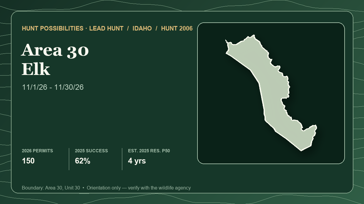
The card above represents lead hunt Idaho 2006 only, not the four-hunt comparison. Its statistics use the connected 2026 season and quota, final 2025 harvest and a 2025 draw-derived planning estimate. The article uses Idaho's newer live 2026 draw tables. Keeping those years explicit prevents a current-season number from being mistaken for a same-year harvest result.
What November changes
By November, the plan should shift away from September calling and toward current feed, security cover, weather and legal access. Snow can expose tracks and move some animals toward seasonal range; it can also close roads, slow a pack-out or concentrate elk on private ground.
Map a connected sequence of durable forage, timber or broken cover, an observation angle and a recovery route. Wyoming's seasonal-range guidance says many big-game animals move toward lower winter range in late fall, but snow and forage change distribution. That supports several elevation plans, not a promise that every herd migrates on the same date.
For every hunt below, ask what the license allows, how tags were allocated, what the harvest report measured, whether public land is reachable and whether an elk can be recovered safely.
Hunt 1: Idaho 2006 — a full November and the cleanest public-land mix
- Current season and weapon: Antlered elk, any weapon, November 1-30, 2026. Idaho authorizes 150 tags.
- Tag path or draw system: Idaho controlled-hunt random drawing; no preference points are used. An unsuccessful year does not create a higher point tier for the next drawing.
- Latest draw demand: In the 2026 first drawing, 787 resident first-choice applicants competed for 135 awards, shown by IDFG as 17%. The nonresident side had 275 first-choice applicants for 15 awards, shown as 5%. Both applicant pools grew from 2025 while the 150-tag total stayed fixed.
- Latest harvest result: IDFG's final 2025 row lists 141 hunters, 88 harvested elk and 62% success over 1,001 hunter-days, or about 7.1 days per hunter. The 2024 success rate was 57% and the 2023 rate was 48%, useful evidence that a single year's 62% should not become a forecast.
- Public-land and access pattern: IDFG's 256,865-acre surface summary lists 46.7% BLM, 29.9% U.S. Forest Service, 20.4% private and 2.9% State of Idaho management. No current Access Yes! property or federally designated wilderness is listed. Management color still does not prove a legal road or public approach.
- Terrain character: A broad mix of open foothill and basin country, broken slopes and forested cover. The variety rewards several observation systems at different elevations instead of one road-dependent basin.
- Principal tradeoff: This is the longest Idaho window and the strongest public-land mix in the comparison, but resident and nonresident demand both rose in 2026. A full month only helps if the hunter can change access and elevation with weather.
- Best for: A hunter who wants a random draw, a full November calendar and enough public-land scale to build several independent plans.
Open Idaho 2006 in the Hunt Planner 3D map.
Hunt 2: Idaho 2040 — later timing with a mixed-ownership warning
- Current season and weapon: Antlered elk, any weapon, November 15-30, 2026. Idaho authorizes 50 tags.
- Tag path or draw system: Idaho random controlled-hunt drawing with no preference-point ladder.
- Latest draw demand: IDFG's live 2026 table lists 451 resident first-choice applicants and 46 awards, displayed as 10%. It lists 57 nonresident first-choice applicants and four awards, displayed as 7%. The overall first-choice pool rose from 479 applicants in 2025 to 508 in 2026.
- Latest harvest result: The 2025 report lists 44 hunters, 29 harvested elk and 66% success over 313 hunter-days, or about 7.1 days per hunter. One reported animal was antlerless even though the current hunt is antlered-only; the official table is historical reporting evidence, not a reason to disregard the 2026 sex limitation.
- Public-land and access pattern: Across the 1,149,590-acre area, IDFG lists 48.5% private, 17.8% U.S. Forest Service, 15.4% reservation/Bureau of Indian Affairs, 12.6% State of Idaho and 3.3% BLM management. An Access Yes! property is currently listed east of Ririe Reservoir/Meadow Creek Junction, but its current rules and map must be checked separately. Tribal or reservation color is not general public hunting permission.
- Terrain character: A large eastern Idaho mix of forest blocks, open foothills and lower agricultural interfaces. Elk visibility and legal access can change at the same time as animals respond to snow and pressure.
- Principal tradeoff: The later opener may better suit a hunter specifically seeking late-fall conditions, and 2025 success was 66%. In return, the season is only 16 days and nearly half the surface summary is private.
- Best for: A hunter comfortable making ownership and permission work the first phase of scouting, not an afterthought once elk are found.
Open Idaho 2040 in the Hunt Planner 3D map.
Hunt 3: Wyoming 001-1 — long season and 97% public, with steep nonresident pools
- Current season and weapon: Any elk, any legal weapon, October 15-November 30, 2026, with a quota of 100. Wyoming also lists a September 1-30 special archery period for hunters who satisfy the state's archery requirements.
- Tag path or draw system: Wyoming limited-quota Type 1. Residents use the resident draw. Nonresidents choose regular or special pools, and licenses are split between preference and random components.
- Latest draw demand: Wyoming's June 15, 2026 resident demand report lists 83 public-draw licenses and 975 first-choice applicants. On the 2026 nonresident regular preference side, six licenses reached 17 points, where four of five applicants drew; nobody below 17 drew. The special preference pool issued five licenses at 15 points to five of eight applicants. The random reports show one regular license among 375 first choices and one special license among 77. Those are separate pools, not one blendable Area 1 percentage.
- Latest harvest result: The 2025 report connected to the local record lists 97 active hunters, 65 elk and 67% success, with 20.0 hunter-days per harvest. Because the license is valid for any elk, that is total elk harvest and cannot be presented as bull success.
- Public-land and access pattern: The WGFD-derived record lists 97% public land. That is the strongest public-land headline here, but it remains a surface summary rather than a guarantee that a road is open, passable or connected to the desired parcel.
- Terrain character: Northeastern Wyoming forest, ridges and openings create a glass-and-still-hunt problem where security cover can sharply reduce visibility. Snow can improve tracking while making shaded or unmaintained roads less forgiving.
- Principal tradeoff: Area 1 combines an early October 15 start, a November 30 close and exceptional public-land scale. The nonresident paths were extremely restrictive in 2026, and the 20.0 days-per-harvest result warns against reading 67% as quick success.
- Best for: A resident or deeply invested nonresident who values public-land scale and can reserve enough time to let weather change the hunt.
Open Wyoming 001-1 in the Hunt Planner 3D map.
Hunt 4: Wyoming 059-1 — a ten-license November hunt with wilderness consequences
- Current season and weapon: Any elk, any legal weapon, November 1-30, 2026. Wyoming's final Chapter 7 table sets a quota of 10 and also lists a September 1-30 special archery period.
- Tag path or draw system: Wyoming limited-quota Type 1 with resident, nonresident regular and nonresident special paths; the nonresident preference and random components must be read separately.
- Latest draw demand: The June 2026 resident report lists eight public-draw licenses and 249 first-choice applicants. The 2026 regular nonresident preference report issued one license at 20 points among four applicants, while the special preference report issued one at 20 points among five. The regular random pool had 32 first-choice applicants and no license; the special random pool had 24 and no license.
- Latest harvest result: The 2025 connected row lists 13 active hunters, 12 elk and 92.3% success, with 8.4 hunter-days per harvest. The sample is tiny and the any-elk limitation means 92.3% is neither a bull-only result nor a stable expectation.
- Public-land and access pattern: The local WGFD-derived record lists 94% public land. Area 59 includes Washakie Wilderness. Wyoming requires a nonresident hunting big game in federally designated wilderness to use a licensed outfitter or be accompanied by a properly licensed Wyoming resident guide, so public acreage and nonresident DIY acreage are not equivalent.
- Terrain character: Remote, steep mountain and wilderness country where snow, stock or foot travel, daylight and extraction margin dominate the decision. A bull located far from legal motorized access can require more recovery capacity than the hunt's high historical success suggests.
- Principal tradeoff: The season is a clean November window and 2025 harvest was strong, but only ten Type 1 licenses exist in 2026. Wilderness rules and a small harvest sample make it the easiest hunt here to overrate from two attractive percentages.
- Best for: A Wyoming resident with backcountry recovery capacity, or a nonresident who has already solved the legal wilderness-guide question and accepts a very restrictive draw.
Open Wyoming 059-1 in the Hunt Planner 3D map.
A November field plan that survives weather
Build three independent access systems. Each needs an observation area, a legal retrieval route and a fallback if snow or mud removes vehicle access. Confirm designated roads with the current land-manager map; the hunt boundary does not authorize cross-country driving.
Use the first day to test elevation and fresh sign. Glass feed-cover edges early and late, then slow down around current tracks, droppings and beds. Keep recovery beside shot planning: estimate the time to reach, break down, cool and pack an elk under the actual forecast. A last-light opportunity without enough meat-care margin is not a responsible shot.
Pressure can move elk toward private land or deeper cover. Do not answer it by crossing a closed road, assuming permission or publishing precise routes and animal locations.
Best fit by hunter priority
- Most calendar flexibility: Idaho 2006 and Wyoming 059-1 cover all of November; Wyoming 001-1 adds October 15-31. Idaho 2006 avoids Wyoming's separate pools and wilderness complication.
- Strongest public-land headline: Wyoming 001-1 at 97%, followed by 059-1 at 94%. Area 59's wilderness rule narrows the nonresident DIY interpretation.
- Later Idaho conditions: Hunt 2040 opens November 15, but mixed ownership demands more access work and a late date does not guarantee snow.
- No-points strategy: Either Idaho hunt. The 2026 resident result was 17% for Hunt 2006 and 10% for Hunt 2040, but both can change annually.
- Wyoming random chance: Area 1 issued one license in each 2026 nonresident random pool; Area 59 issued none. Idaho remains random by design.
There is no universal winner. Idaho reports mandatory-harvest data and uses a random controlled draw. Wyoming reports survey-based harvest estimates and divides nonresidents into regular and special preference and random pools. Wyoming's any-elk success also cannot be compared directly with Idaho's antlered-only success. The right choice is the tag system and field problem a hunter is actually equipped to solve.
Verification checklist
- Confirm the 2026 season dates, weapon, sex limitation, quota and boundary for the exact hunt number or license type.
- Recheck the draw pool and residency rules. Carry no odds, applicant count or point tier into 2027 without its year and pool label.
- Verify parcel ownership, legal public ingress, road designation, seasonal gates, fire restrictions and weather closures immediately before travel.
- Treat reservation, tribal and private land as permission questions, not public-land substitutes. Reopen any Access Yes! property rules before relying on it.
- For Wyoming Area 59, map designated wilderness and solve the nonresident guide requirement before counting that country as usable.
- Confirm chronic-wasting-disease testing guidance, carcass-transport rules, evidence-of-sex requirements and any local sampling request.
- Build a conservative meat-care and retrieval plan for warm afternoons, deep snow and a disabled vehicle. The hunt is not complete at the shot.
Official regulations, quotas, access programs, road status and weather can change. The 2026 season and draw evidence is newer than the 2025 harvest evidence, and each state measures harvest differently. Use Hunt Planner for comparison and terrain orientation, then verify the agency materials again before applying and before hunting. Read the methodology, editorial and AI policy and corrections process.
Sources and verification
- IDFG Hunt Planner: Hunt 2006 current season, 2026 draw, 2025 harvest and surface management
- IDFG Hunt Planner: Hunt 2040 current season, 2026 draw, 2025 harvest and surface management
- IDFG 2026 Big Game Seasons and Rules
- IDFG controlled-hunt information and random-draw guidance
- IDFG motorized hunting rule
- Wyoming 2026 Chapter 7 elk seasons, quotas and limitations
- Wyoming 2026 resident elk demand report
- Wyoming 2026 nonresident regular preference elk report
- Wyoming 2026 nonresident special preference elk report
- Wyoming 2026 nonresident regular random elk report
- Wyoming 2026 nonresident special random elk report
- Wyoming Game and Fish harvest reports and surveys
- Wyoming seasonal-range definitions and late-fall migration context
- Wyoming nonresident wilderness guide requirement
- Wyoming Game and Fish: CWD detected in Elk Hunt Area 59
This article uses current official agency material only. No hunter report is presented as evidence. It was prepared with AI-assisted research and drafting, then checked against the linked sources and local Hunt Planner records. Official agency sources control, and readers should report a mismatch through the corrections page.