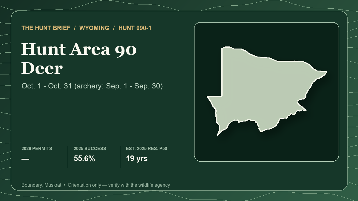
Wyoming deer Hunt 090-1 opens its any-legal-weapon season today, October 1, 2026, with 50 licenses authorized for antlered mule deer or any white-tailed deer. The current draw was severe: Wyoming Game and Fish Department's June 15 resident demand report lists 28 licenses against 592 first-choice applicants, a raw quota-to-first-choice ratio of 4.7%.
The map can look more welcoming than the draw. WGFD estimates Area 90 at 78% public land and rates access to public land “Good,” yet it also marks the license with its difficult-public-access asterisk. That is not a contradiction to dismiss. The agency says the area contains large, generally reachable Bureau of Land Management blocks, but mule deer occur at relatively low density and private ground complicates the northeast. Public acreage is abundant; finding deer on the portion a hunter can lawfully and practically reach is the harder test.
Start with the static Hunt Planner profile for Hunt 090-1 and open Area 90 in the Hunt Planner 3D map. The boundary card above uses the actual Muskrat hunt boundary. It is an orientation graphic, not an ownership, road-status or navigation map.
The quick verdict
Hunt 090-1 best fits a tag holder prepared for a low-density mule deer search across open sage country, with enough time to test several legal access systems. It is a weaker fit for someone equating a high public-land percentage with high deer density, depending on one two-track road, or arriving without self-contained water and a wet-weather exit plan.
For future applicants, the 2026 resident draw improved modestly from 2025 but remained a long shot. Nonresidents faced separate preference and random pools; those results cannot be blended into one percentage or compared directly with the resident draw.
What the 2026 license authorizes
The final 2026 Chapter 6 regulation lists Hunt Area 90 Type 1 with a September 1–30 special-archery season and an October 1–31 regular season. The license is valid for an antlered mule deer or any white-tailed deer, and the regulation sets the total quota at 50.
The special-archery window is now closed. A hunter entering during October should verify that the license, weapon, hunter-education status and any separate archery requirements match the current rules rather than relying on the date line alone. WGFD also notes overlapping antelope seasons in Areas 67 and 74, so hunters should expect other legal activity on parts of the landscape.
Resident demand eased, but 592 first choices is still pressure
The 2026 resident demand report shows 28 draw licenses and 592 first-choice applicants. The raw 4.7% ratio is not a personalized probability: party applications, allocation rules and applicant choices affect an individual outcome.
In 2025, the comparable report listed 25 licenses and 664 first choices, or 3.77%. First-choice demand therefore fell by 72 applications, or 10.8%, while the published resident draw inventory increased by three. That made the raw ratio less restrictive, but not easy. The season-wide regulation quota was 50 in both years; draw reports break inventory into residency, landowner, preference, random, regular and special pools, so their rows should not be added casually.
The 2026 nonresident regular random report lists one license against 49 first choices, a raw 2.0% ratio. The special random pool lists one against 16, or 6.3%. In the preference pools, all available regular and special licenses were gone after the 16-point rows: the regular pool issued five licenses across the 17- and 16-point tiers, while the special pool issued three. That describes one completed draw, not a future point guarantee. The special pool changes price and applicant pool, not the hunt boundary or season.
A 55.6% harvest rate came with 226 hunter-days
WGFD's 2025 harvest report estimates 45 active Type 1 hunters, 25 mule deer harvested and 226 hunter-days. That is 55.6% success and about nine hunter-days per harvested deer. The resident estimate was 17 deer for 33 active hunters; the nonresident estimate was eight for 12. The weapon table attributes all 25 harvested deer to firearm hunters and none to archery hunters.
Those figures describe last season's respondents and estimates, not a 2026 forecast. They also do not separate public-land and private-land outcomes. The useful planning signal is effort: a 31-day calendar did not produce quick success for every participant, and the agency's hunt-area guidance explicitly says deer density is low.
WGFD's 2025 Beaver Rim herd report adds population context. It says the herd had been below objective for more than 10 years and described recent population growth as absent, while maintaining a limited-license strategy intended to provide a quality experience. The report also cautioned that biological samples were small. A hunter should not turn “quality” into a promise about animal numbers or antler class.
Why 78% public land still requires an access plan
Area 90 is predominantly sagebrush grassland cut by ephemeral sandy washes. Beaver Rim defines much of the southern and eastern edge, with sparse conifer cover, springs and seeps; the Gas Hills provide the other notable timber. WGFD says mule deer use sagebrush draws, riparian areas and rocky canyon habitat, with the greatest densities broadly along Beaver Rim. White-tailed deer are scarce.
That is habitat orientation, not a location prescription. Keep scouting at the pattern level: compare security cover, broken rim-and-draw terrain, riparian structure and broad transitions, then let current sign and legal access narrow the plan. Do not publish or trade precise camps, glassing points, water locations, routes or animal coordinates.
The agency lists multiple Walk-In Areas, but each property has its own current boundary, species authorization, dates and rules. Verify those pages before relying on them. In the northeast, larger private blocks can complicate ingress. Elsewhere, confirm the entire route—not only the destination parcel—and do not assume a road crossing private land is public.
Weather can change the logistics quickly. WGFD warns that wet snow or rain can make many two-track roads difficult and recommends moving camp trailers near graveled county roads when precipitation is likely. It also says BLM dispersed camping is available but suitable water sources are not, so arrive able to carry the water the trip requires.
Opening-week field plan
- Build several complete access chains with confirmed land status, public-road authority, parking, foot travel and recovery before leaving pavement.
- Divide scouting among broad sage-draw, riparian and broken-rim habitat patterns rather than repeatedly driving the most obvious road network.
- Keep a precipitation trigger: know when to move vehicles or trailers back toward durable roads before clay and two-tracks become the hunt's controlling problem.
- Carry water for camp and field use; do not build the plan around an unmapped spring or seasonal seep.
- Check current fire restrictions, weather, road closures, Walk-In rules and overlapping-season traffic immediately before each entry.
- Review current chronic-wasting-disease testing, carcass-transport and disposal rules. WGFD has confirmed CWD in Area 90; do not consume an animal that tests positive or appears ill.
Hunt 090-1 offers a long October season and substantial public ground, but neither cancels low deer density or a demanding draw. The best plan treats access, water, road durability and search time as connected constraints—not as problems to solve independently after opening morning.
Sources and verification
- WGFD Hunt Planner: Area 90 season, access rating, public-land estimate, terrain and 2025 harvest
- WGFD final 2026 Chapter 6 deer seasons
- WGFD 2026 resident deer demand report
- WGFD 2026 nonresident regular random deer demand report
- WGFD 2026 nonresident special random deer demand report
- WGFD 2026 nonresident regular preference-point deer demand report
- WGFD 2026 nonresident special preference-point deer demand report
- WGFD 2025 resident deer demand report
- WGFD 2025 deer harvest report
- WGFD 2025 Beaver Rim Mule Deer management report
- WGFD public-access summary
- WGFD Area 90 CWD detection notice
Official seasons, license allocations, draw systems, Walk-In enrollment, land status, roads, fire restrictions, weather and CWD rules can change. The season, quota and draw evidence are from 2026; the latest completed harvest is from 2025, while the card's estimated resident draw scenario also uses 2025 local data. Historical harvest and draw results do not predict an individual outcome. This article uses official agency material only and presents no hunter report as representative evidence. It was prepared with AI-assisted research and drafting, then checked against the linked sources. Read Hunt Planner's methodology, editorial and AI policy and corrections process.