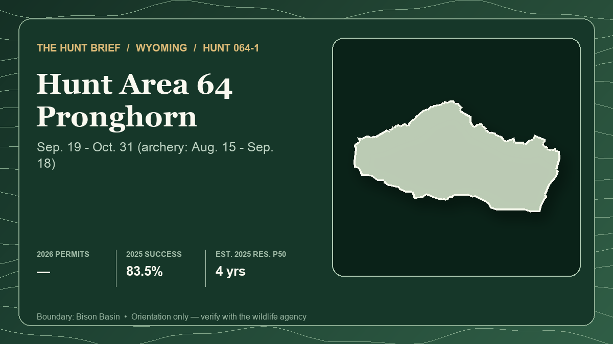
Wyoming pronghorn Hunt 064-1 is nine days from its August 15, 2026 special-archery opener. For a tag holder, the most important planning fact is not the 95% public-land figure or the 83.5% harvest headline. It is that Wyoming Game and Fish publishes mixed access signals on the same current hunt page: a “Difficult Public Access” warning beside the season table, but “Good” access and approximately 95% public land in the access section.
That contradiction does not make the hunt unknowable. It makes parcel, route and restriction verification the first scouting job. Start with the static Hunt Planner profile for 064-1 and open Hunt 064-1 in the Hunt Planner 3D map. The card above shows the Bison Basin boundary and the latest local structured statistics. It is an orientation aid, not proof that a road is public or open.
The quick verdict
Hunt 064-1 best fits a tag holder who can treat remote access as a field problem: verify more than one legal arrival route, carry enough fuel and water for long distances, and keep an all-weather backup outside alkaline bottoms. Its long archery window, later any-legal-weapon season and large public-management footprint create options, but none substitutes for a current travel map.
This is not a leftover-license recommendation. WGFD's July 6, 2026 leftover reports list zero Hunt 064-1 quota for both residents and nonresidents. The brief is for current tag holders and future planners, not a claim that a license can be bought today.
What the 2026 license authorizes
WGFD lists 064-1 as an any-antelope Type 1 license. The special-archery season runs August 15 through September 18, 2026; the regular season runs September 19 through October 31, 2026. A hunter using archery equipment in the special period needs the appropriate antelope license and a Wyoming archery license. The regular Type 1 season allows any legal weapon subject to the current rules.
The season structure matters when reading the harvest evidence. A license holder can hunt more than a month with a bow and then continue during the regular season. The published success rate therefore describes the full license, not bowhunting alone.
The 2026 demand shift
The official resident demand report dated June 15, 2026 lists 116 licenses and 401 first-choice applicants for Area 64 Type 1. In the comparable June 10, 2025 report, WGFD listed 74 licenses and 419 first-choice applicants. Resident quota increased by 42 licenses, or 56.8%, while first-choice demand declined by 18 applicants, or 4.3%.
The raw 2026 quota-to-first-choice ratio is about 28.9%, up from the official 17.66% resident first-choice odds shown for 2025. Treat that as a description of this year's report, not a forecast. Party applications, future quota changes and changing demand can alter actual outcomes, and a single improved year does not establish a trend.
Nonresident pathways must stay separate. For 2026, WGFD's regular reports list 12 licenses in the preference pool and four in the random pool against 195 first-choice applicants. The special-price reports list nine preference licenses and three random licenses against 49 first-choice applicants. A special license changes the pool and price; it does not create a different hunt boundary or season. Do not combine those pools into one universal nonresident odds percentage.
What the 2025 harvest report says—and does not say
The latest completed harvest evidence is from 2025. WGFD reports 97 active Type 1 hunters, 81 harvested bucks and 83.5% success. Hunters reported 339 days afield, or 4.2 days per hunter. Residents accounted for 60 bucks from 76 active hunters, while nonresidents harvested 21 bucks from 21 active hunters.
The weapon table adds an essential qualifier: two reported bucks were taken with archery equipment and 79 with firearms. That is not a 2% archery success rate because the table does not state how many license holders actually hunted during the special-archery season. It only shows the method used for harvested animals. The overall 83.5% is a full-season result and should not be sold as a bowhunting forecast.
The 2025 harvest year and 2026 demand year answer different questions. Harvest describes hunters who held and used the license last fall; demand describes this year's application pool. Multiplying them into a single “opportunity” number would create false precision.
Why 95% public can still require an access audit
WGFD's current Hunt Planner describes Area 64 as sagebrush prairie, rolling hills, saltbush and greasewood flats, with rocky country in the Antelope Hills, conifer cover near Crooks Mountain and riparian meadows along major waterways. It says much of the area is remote and far from services or cell coverage. It also warns that alkaline and creek-bottom roads can become muddy and nearly impassable when wet.
Those details explain why public acreage and practical access are different metrics. A public polygon may be isolated by a road crossing private land, a route may be closed to motor vehicles, or weather may turn an otherwise legal road into a retrieval liability. Private parcels concentrate along watercourses even though they make up a small share of the area. Verify ownership on both sides of every approach and fence.
There is also a current agency-data mismatch worth checking directly. The Area 64 Hunt Planner links Fremont County Walk-In Area 22, but the current Walk-In page lists that property's antelope authorization as Hunt Area 107—not 64. Do not rely on the link alone. Confirm the printed Walk-In map, species table and current rules with WGFD before using that parcel for 064-1.
A field plan for August through October
Build the hunt around broad habitat and route systems, not a named waterhole or a shared pin:
- For the August archery period, identify several observation zones where low folds, rocky breaks or taller sage can hide an approach. Pronghorn vision punishes movement across open skylines.
- Verify water and forage conditions in person. The official page says densities often increase at higher elevations with more water and lush forage, but that is a habitat pattern—not a promise that animals use one tank or meadow.
- Keep at least two lawful routes for each broad scouting zone. Mark private crossings, route designations and turnaround points before committing a vehicle.
- Prepare for dry heat, wind, freezing nights or early snow. Carry extra fuel, water, food, a full-size spare and a retrieval plan that works without cell service.
- Recheck fire restrictions immediately before travel. As of August 6, 2026, BLM's Wyoming page lists Stage 1 restrictions affecting the Lander Field Office and multiple counties in the region. The exact order depends on parcel and jurisdiction.
- Expect distribution to change. WGFD says the local rut typically peaks in the last week of September and first part of October, while fall storms can initiate movement from higher elevations.
Keep every published scouting note at the habitat-pattern level. Do not share exact camps, water sources, private approaches, glassing points or animal coordinates.
Verification checklist
- Match the printed license to Hunt 064-1, Type 1 and the current any-antelope limitation.
- Confirm August 15–September 18 special-archery dates and September 19–October 31 regular dates in the 2026 rules.
- Carry the required archery license during the special-archery period.
- Compare every planned road with current ownership, travel-management and closure information.
- Treat the Hunt Planner's 95% public figure as approximate surface ownership, not a legal-access percentage.
- Verify the Walk-In Area 22 mismatch with WGFD rather than assuming Hunt 64 is authorized there.
- Check current BLM and county fire orders, weather and road conditions immediately before departure.
Sources and verification
- WGFD Hunt Planner: Area 64 season, public-land estimate, access notes, terrain and 2025 harvest
- WGFD 2026 antelope regulation brochure: license limits, special-archery rules and Area 64 boundary
- WGFD 2026 resident antelope demand report
- WGFD 2026 nonresident regular random antelope demand report
- WGFD 2026 nonresident regular preference-point antelope demand report
- WGFD 2026 nonresident special random antelope demand report
- WGFD 2026 nonresident special preference-point antelope demand report
- WGFD 2026 resident leftover antelope demand report
- WGFD 2026 nonresident leftover antelope demand report
- WGFD 2025 antelope harvest report
- WGFD Fremont County Walk-In Area 22: current species and hunt-area listing
- BLM Wyoming fire restrictions
Official regulations, draw tables, boundaries, access permissions, road status, fire orders and weather can change. The 2026 demand reports are newer than the local card's 2025 draw history; the latest completed harvest evidence is also from 2025. The conflicting access labels and Walk-In link are reported as current verification issues, not silently resolved. This article uses official agency material only, and no hunter report is presented as evidence. It was prepared with AI-assisted research and drafting, then checked against the linked sources. Read Hunt Planner's methodology, editorial and AI policy and corrections process.